
Climbing Mount Ulawun: Papua New Guinea’s Most Active Stratovolcano Trekking Guide
Mount Ulawun, Papua New Guinea’s highest and most active volcano, offers a demanding trek through dramatic volcanic landscapes. This guide covers its geology, trekking routes, safety, and cultural significance for adventurous volcano hikers.
Quick Volcano Snapshot
| Volcano type | Stratovolcano |
|---|---|
| Elevation | 2334 meters |
| Location | West New Britain, Papua New Guinea |
| Activity status | Active |
| Trekking difficulty | Demanding |
| Typical trek duration | 2-3 days |
| Altitude gain | Approximately 1500 meters |
| Terrain type | Volcanic ash, pumice, lava rock, rainforest |
| Best season | May to October (dry season) |
| Temperature range | 5°C to 25°C |
| Permit requirement | Mandatory trekking permit |
The Experience of Hiking Mount Ulawun
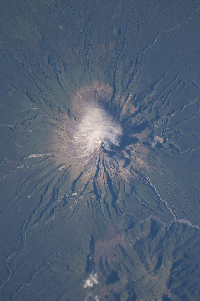
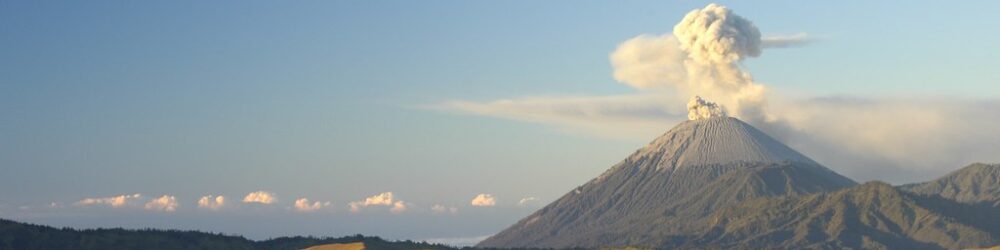
Approaching Mount Ulawun, the landscape transforms from dense tropical rainforest to stark volcanic slopes. The volcano’s symmetrical cone rises sharply, often crowned with plumes of steam and ash. Trekking here immerses hikers in raw geological power, revealing layers of volcanic history at every step. The contrast between fertile lowlands and barren lava fields highlights nature’s force. Reaching the crater rim, trekkers encounter the volcano’s simmering heart, a place of intense energy and elemental drama.
Mount Ulawun: Geological Background
Mount Ulawun is a basaltic-andesitic stratovolcano formed by the subduction of the Solomon Plate beneath the Pacific Plate. Its steep cone consists of alternating lava flows and tephra layers. Known for frequent Strombolian and Vulcanian eruptions, Ulawun produces ash plumes, pyroclastic flows, and occasional lava streams. The summit crater hosts fumaroles emitting sulfurous gases and steam, creating vivid mineral deposits. This active volcano continuously shapes the surrounding landscape and poses ongoing hazards to nearby communities.
Terrain and Hiking Experience on Mount Ulawun
The trek involves steep ascents over loose volcanic ash and pumice, combined with rugged lava rock scrambling. Trails can be slippery and unstable, requiring careful footing. Altitude effects become noticeable near the summit, with cooler temperatures and stronger winds. The volcanic terrain includes sharp rocks and shifting scree fields. The physical challenge is heightened by remote jungle approaches and sudden weather changes, demanding endurance and alertness from hikers.
What Makes the Mount Ulawun Trek Unique
Mount Ulawun’s status as one of Papua New Guinea’s most active volcanoes makes this trek exceptional. Its frequent eruptions create a dynamic and ever-changing landscape rarely seen elsewhere. The volcano’s symmetrical cone and persistent degassing fumaroles offer dramatic geological features. Cultural connections to local communities add depth, as Ulawun holds spiritual significance. The remote location in the Bismarck volcanic arc enhances the sense of adventure, with few trekkers venturing into this wild volcanic frontier.
The Summit and Crater Experience
At the summit, hikers face a steaming crater rim emitting sulfurous odors and intense heat from fumaroles. The sound of escaping gases punctuates the stillness. Panoramic views extend over the Bismarck Sea and surrounding volcanic peaks, framed by drifting ash clouds. The crater’s raw energy is palpable, offering a sensory encounter of heat, smell, sound, and sight that creates a profound connection to Earth’s inner forces.
Best Time to Trek Mount Ulawun
The optimal trekking season is during the dry months from May to October, when trails are less slippery and weather conditions are more stable. Avoid the monsoon season from November to April due to heavy rains and increased landslide risk. Volcanic activity can fluctuate; always check current alerts from the Rabaul Volcano Observatory before planning your trek. Early morning starts are recommended to avoid afternoon storms and to enjoy clearer summit views.
Trekking Routes and Trail Options
The primary route begins at the village of Ulawun, ascending through dense rainforest before reaching volcanic slopes. The trek covers approximately 10 to 12 kilometers with an altitude gain of around 1500 meters. It is typically completed in 2 to 3 days, with an overnight camp near the tree line. Guided treks are strongly advised due to the volcano’s active status and challenging terrain. Alternative routes exist but are limited and less maintained, emphasizing the need for local expertise.
Difficulty Assessment
Mount Ulawun is classified as a demanding volcano trek. The steep, unstable volcanic terrain requires good physical fitness and surefootedness. Altitude sickness can affect some hikers above 2000 meters. While no technical climbing gear is generally needed, experience with rugged mountain hiking is essential. This trek is unsuitable for beginners and should be attempted only by well-prepared, experienced volcano hikers.
Essential Volcano Trekking Gear
Key gear includes sturdy hiking boots with excellent grip, trekking poles for stability on loose ash, and volcanic ash gaiters to protect against fine particles. A windproof and waterproof jacket is vital for sudden weather changes. Carry a respirator or dust mask to guard against volcanic gases and ash. Headlamps are necessary for early starts or late finishes. Ample hydration systems and sun protection are critical due to exposed terrain and tropical sun.
Safety and Volcanic Hazards
Ulawun’s active status poses risks including sudden eruptions, ashfall, pyroclastic flows, and toxic gases. Summit approaches can be dangerous during heightened activity. Unstable crater edges and loose scree increase accident risk. Always monitor updates from the Rabaul Volcano Observatory and adhere strictly to local safety advisories. Emergency evacuation options are limited due to the remote location. Proper preparation and guided support are essential for safe trekking.
Permits, Guides, and Logistics
A trekking permit is mandatory and can be obtained through Papua New Guinea’s Tourism Authority or authorized operators. Permit processing can take several weeks, so plan well in advance. Local guides are required for safety and navigation. Logistics are complex due to remote access; transport to trailheads often involves multiple modes including road and boat. Hiring experienced guides familiar with volcanic conditions and local culture is strongly recommended.
Where to Stay Near Mount Ulawun
Accommodation options near Mount Ulawun are limited and basic. Most trekkers stay in local villages or simple lodges in West New Britain’s main towns such as Kimbe. Camping near the trailhead or on the volcano itself is common during multi-day treks. Eco camps and community guesthouses offer cultural immersion but minimal amenities. Planning for self-sufficiency and bringing necessary supplies is essential given the remote setting.