Mount Marapi Volcano Trekking Guide: Exploring West Sumatra’s Most Active Stratovolcano
Mount Marapi, one of Sumatra’s most active stratovolcanoes, offers adventurous trekkers a challenging ascent through volcanic ash slopes, rugged lava terrain, and steaming fumaroles. This guide covers geological insights, trekking routes, safety tips, and cultural context for an unforgettable volcano hiking experience in West Sumatra, Indonesia.
Quick Volcano Snapshot
| Volcano type | Stratovolcano |
|---|---|
| Elevation | 2,891 meters |
| Location | West Sumatra, Indonesia |
| Activity status | Active |
| Trekking difficulty | Moderate |
| Typical trek duration | 4–6 hours ascent, 3–4 hours descent |
| Altitude gain | Approx. 1,500 meters |
| Terrain type | Volcanic ash slopes, lava fields, rocky scree |
| Best season | May to September (dry season) |
| Temperature range | 5°C to 25°C |
| Permit requirement | Required |
The Experience of Hiking Mount Marapi
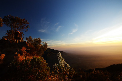
Approaching Mount Marapi, the landscape shifts dramatically from lush tropical forests to stark volcanic ash and rugged lava fields. The air carries a faint sulfur scent, hinting at the mountain’s restless nature. As you ascend, the terrain becomes increasingly raw and elemental, exposing the geological forces that shape this active stratovolcano. Reaching the crater rim, the panorama unfolds with steaming fumaroles and distant peaks, a powerful reminder of Earth’s dynamic energy. The climb is both a physical challenge and a profound encounter with volcanic power.
Geological Background of Mount Marapi
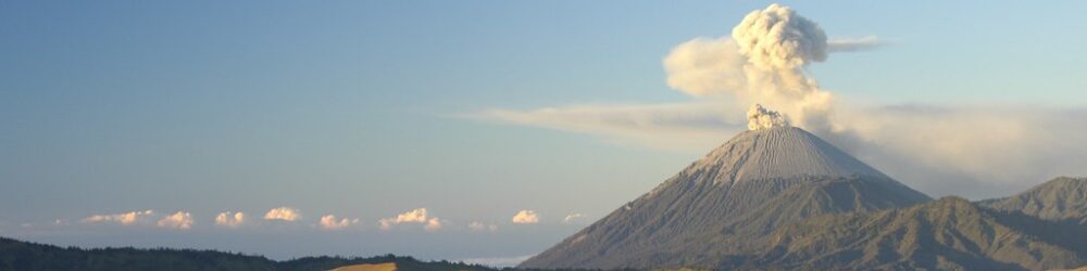
Mount Marapi is a classic stratovolcano formed by successive layers of hardened lava, ash, and volcanic debris. Its activity is characterized by frequent eruptions, with shallow magma sources causing sudden explosive events. The volcano’s summit features a complex crater with fumaroles emitting sulfurous gases and steam. Historical eruptions, notably in 1979 and 2023, have shaped the surrounding landscape with fresh lava flows and ash deposits. The mineral-rich volcanic soils support unique flora, while sulfur deposits and steaming vents mark the mountain’s volatile geology.
Terrain and Hiking Experience on Mount Marapi
The trek begins through dense tropical forest that gradually thins as you climb into volcanic terrain. Hikers encounter steep ash slopes that can be slippery and loose, requiring careful footing. Rocky lava fields and scree slopes demand agility and balance, with occasional boulder scrambling near the crater. Wind intensifies near the summit, and temperature drops are noticeable. The trail’s ruggedness and altitude gain make the hike physically demanding but rewarding, offering dramatic views and close encounters with volcanic features.
What Makes Mount Marapi Trek Unique
Mount Marapi stands out as one of Sumatra’s most active volcanoes, with frequent eruptions that shape its landscape in real time. The trek offers rare access to a live volcanic environment with steaming fumaroles and fresh ash deposits. Unlike more touristy volcanoes, Marapi’s trails are less crowded, providing a raw and authentic adventure. The proximity of local villages adds cultural depth, while the mountain’s unpredictable activity demands respect and vigilance, heightening the sense of adventure.
Summit and Crater Experience
Reaching Mount Marapi’s summit, hikers are greeted by a vast crater rim steaming with sulfur vents and fumaroles. The sulfurous smell is pungent, and the ground radiates heat in places. The crater’s rugged edges offer panoramic views of West Sumatra’s volcanic landscape, with distant peaks and ash-covered valleys. The sound of escaping gases and occasional rumblings underscore the volcano’s restless nature. This sensory immersion—sight, smell, sound, and heat—creates a profound connection to the Earth’s inner forces.
Best Time to Trek Mount Marapi
The optimal trekking season is during the dry months from May to September, when trails are less slippery and weather conditions are more stable. Avoid the monsoon season (October to April) due to heavy rains and increased risk of landslides. Volcanic activity can cause sudden closures; always check current alerts from the Volcanological Survey of Indonesia before planning your trek. Early morning climbs are recommended to avoid stronger daytime sulfur emissions and to catch spectacular sunrises.
Trekking Routes and Trail Options
The primary and safest route to Mount Marapi’s summit starts from the village of Rubai, ascending through forested slopes to volcanic ash fields and the crater rim. This trail covers approximately 7 kilometers with an elevation gain of about 1,500 meters. The southern route is currently closed due to volcanic hazards. Guided treks are strongly advised for safety and navigation. The ascent typically takes 4 to 6 hours, with descent lasting 3 to 4 hours. Trail markers and local guides help manage the challenging terrain.
Difficulty Assessment
Mount Marapi is classified as a moderate volcano trek. The terrain includes steep ash slopes, loose volcanic scree, and rocky sections requiring sure-footedness. Altitude and exposure to volcanic gases add to the challenge. No technical climbing skills are needed, but good physical fitness and hiking experience are essential. The unpredictable volcanic activity demands caution and adherence to safety guidelines. This trek suits adventurous hikers comfortable with moderate physical exertion and variable trail conditions.
Essential Volcano Trekking Gear
Key gear includes sturdy hiking boots with excellent grip for ash and rocky terrain, trekking poles for stability, and gaiters to protect against volcanic ash. A windproof and waterproof jacket is essential due to sudden weather changes. Carry a gas mask or respirator to guard against sulfur fumes near the crater. Headlamps are necessary for early morning or night climbs. Ample water, sun protection (hat, sunscreen), and layered clothing for temperature shifts complete the essential kit.
Safety and Volcanic Hazards
Mount Marapi’s active status poses risks including sudden eruptions, toxic volcanic gases, unstable crater edges, and falling rocks. Loose scree and ash slopes increase slip hazards. Always monitor official volcanic activity updates from Indonesian authorities. Stay within designated trails and respect exclusion zones around the crater. Hiring local guides enhances safety. Emergency response infrastructure exists but can be limited; preparedness and caution are paramount to minimize risk.
Permits, Guides, and Logistics
Climbing Mount Marapi requires permits issued by local government and conservation agencies. Permits help regulate access due to volcanic hazards. Hiring a certified local guide is strongly recommended for safety and navigation. Guides provide valuable knowledge on volcanic conditions and cultural context. Entry fees support conservation and emergency services. Check for seasonal closures or restrictions linked to volcanic activity. Arrange permits and guides in advance through local offices or trekking agencies in West Sumatra.
Where to Stay Near Mount Marapi
Accommodation options near Mount Marapi include homestays and guesthouses in villages such as Rubai and Gobah Cumantiang, located within a few kilometers of the trailhead. These provide basic amenities and local hospitality. For more comfort, travelers can stay in Bukittinggi or Padang, about 1.5 to 2 hours away by road. Staying near the trailhead allows early starts and better acclimatization. Booking in advance during peak trekking season is advisable.