Mount Papandayan Volcano Trekking Guide: Exploring West Java’s Active Stratovolcano with Sulfur Craters and Edelweiss Fields
Discover the thrilling yet accessible trek of Mount Papandayan, an active stratovolcano in West Java, Indonesia. This guide covers its unique fumaroles, sulfur vents, crater lake, diverse terrain, and practical trekking advice for adventurers and geology enthusiasts.
Quick Volcano Snapshot
| Volcano type | Stratovolcano |
|---|---|
| Elevation | 2,665 meters |
| Location | West Java, Indonesia |
| Activity status | Active |
| Trekking difficulty | Easy to Moderate |
| Typical trek duration | 1-2 days |
| Altitude gain | Approximately 600 meters |
| Terrain type | Lava fields, sulfur vents, ash slopes, crater lake, edelweiss meadows |
| Best season | Dry season (May to September) |
| Temperature range | 10°C to 25°C |
| Permit requirement | Yes, park entry and trekking permits required |
Introduction: The Experience of Hiking Mount Papandayan
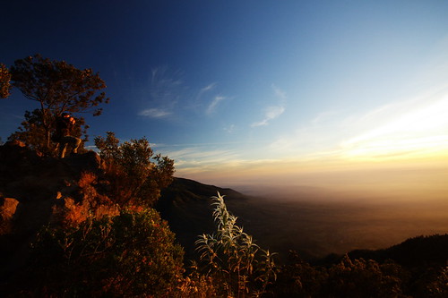
Approaching Mount Papandayan, the landscape unfolds with stark contrasts: barren sulfur-stained craters emitting steam and pungent sulfur scents, juxtaposed against lush edelweiss meadows and dense forest patches. The air vibrates with the raw geological energy of an active volcano. Hiking here is a sensory journey through a living geological laboratory, where every step reveals the Earth’s fiery pulse. Reaching the crater rim, the panorama opens to steaming fumaroles and a shimmering crater lake, evoking awe and a profound connection to volcanic power.

The Volcano Itself: Geological Background
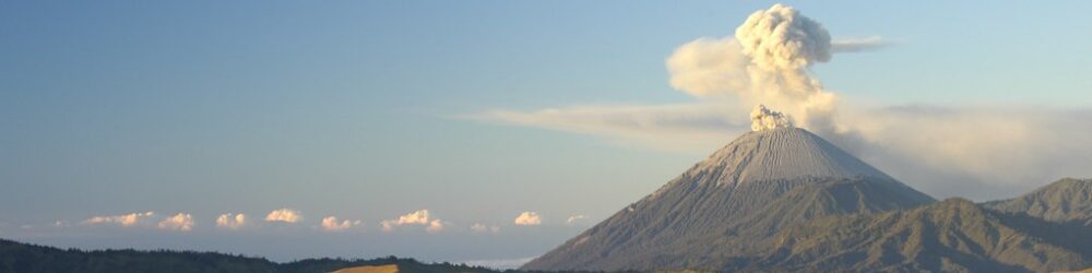
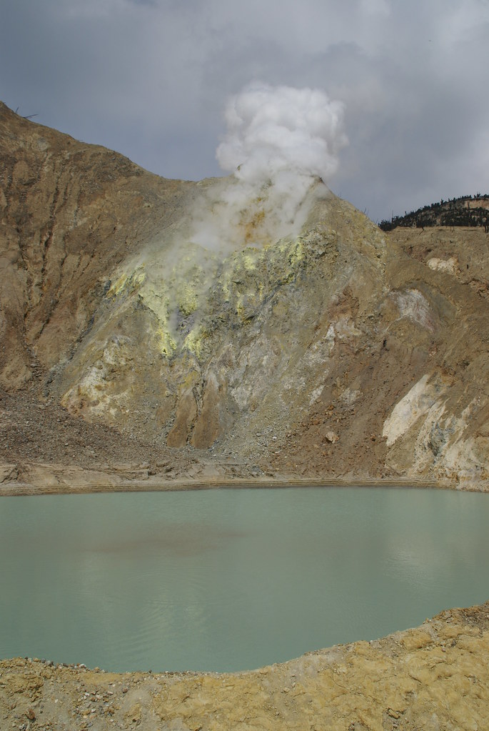
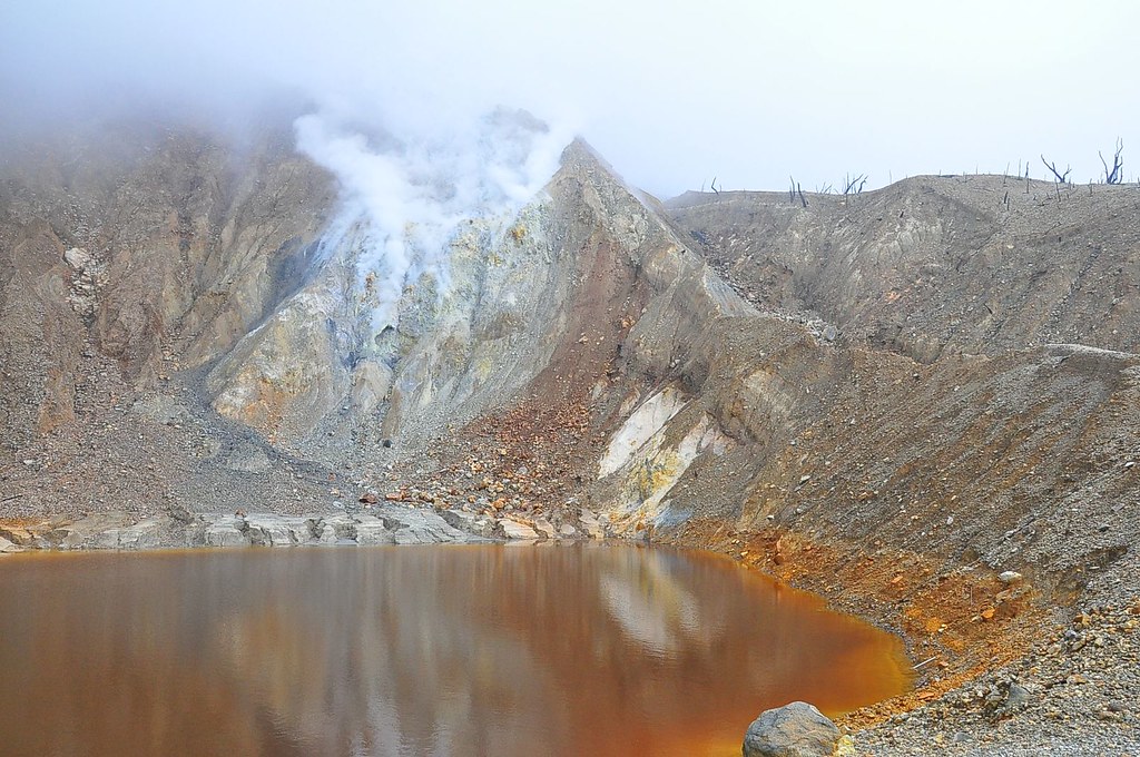
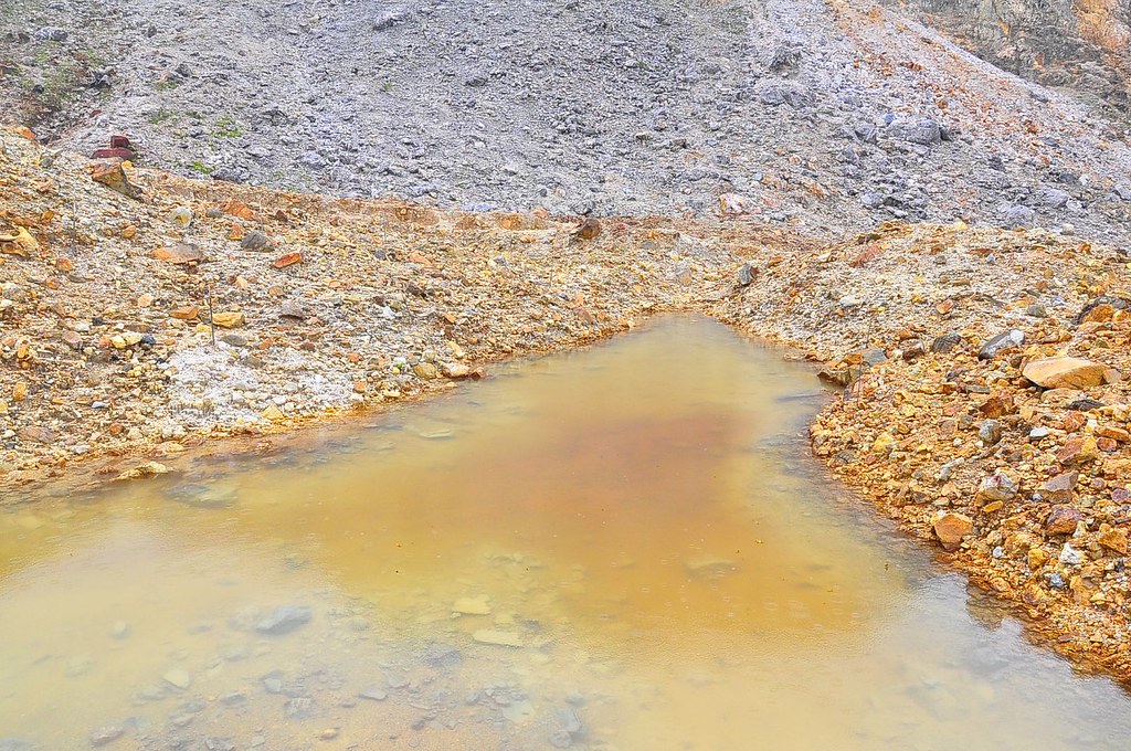
Mount Papandayan is a complex stratovolcano formed by successive layers of lava and ash from multiple eruptions. It features four main summit craters: Kawah Nangklak, Kawah Pengantin, Kawah Emas, and Kawah Baru. The volcano’s explosive eruptions, notably in 1772, 1923, 1942, and 2002, have shaped its rugged terrain. Active fumaroles and sulfur vents release volcanic gases, coloring the landscape with vivid yellows and whites. The crater lake in Kawah Baru, formed after the 2002 eruption, displays shifting hues from blackish green to clear, surrounded by charred forest remnants. These features offer a dynamic glimpse into volcanic processes.
The Volcano Trek: Terrain and Hiking Experience
The trek to Papandayan’s summit is characterized by well-marked trails traversing varied terrain. Hikers encounter soft volcanic ash slopes, rugged lava rock fields, and patches of loose pumice. The path winds through the haunting Dead Forest, where charred trees stand as silent witnesses to past eruptions. Meadows of delicate edelweiss bloom in open savannas, providing a serene contrast. Altitude effects are mild but noticeable near the summit, where cool winds and temperature drops add to the challenge. The terrain demands steady footing but remains accessible to most with moderate fitness.
What Makes This Volcano Trek Unique
Mount Papandayan’s trek stands out for its active fumaroles and sulfur vents that steam and hiss close to the trail, offering intimate encounters with volcanic activity. The presence of a crater lake within the newest crater adds a rare aquatic element. The Dead Forest, a surreal expanse of scorched trees, creates an eerie yet captivating landscape. Seasonal blooms of edelweiss flowers paint the meadows in white, enhancing the trek’s visual appeal. The accessibility of these features combined with the volcano’s active status makes Papandayan a unique destination for volcano enthusiasts.
The Summit and Crater Experience
Reaching the summit reveals a dramatic panorama of steaming craters and rugged peaks. The air is thick with the sharp scent of sulfur, and the ground vibrates subtly with geothermal heat. Fumaroles hiss and release plumes of white steam, while bubbling mud pools add to the sensory spectacle. The crater lake’s shifting colors reflect the volatile nature of the volcano. From the rim, expansive views stretch over West Java’s lush landscapes, punctuated by distant mountain silhouettes. This moment is a powerful reminder of Earth’s dynamic forces.
Best Time to Trek Mount Papandayan
The optimal trekking season is during the dry months from May to September, when trails are less slippery and weather conditions are stable. Early mornings offer crisp air and clear views, ideal for sunrise hikes. Avoid the monsoon season (October to April) due to heavy rains and increased volcanic gas emissions. Monitoring by local volcanology agencies ensures safety, and hikers should heed any temporary closures or warnings related to volcanic activity.
Trekking Routes and Trail Options
The primary route starts at the Papandayan Basecamp near Cisurupan village, ascending approximately 600 meters over 6 kilometers to the crater area. This trail is well-maintained and suitable for self-guided hikers and guided groups. Alternative approaches from Cileuleuy and Pangalengan exist but are less frequented. The standard trek can be completed in a day, though many opt for a two-day itinerary to camp near the crater and enjoy sunrise views. Guided tours often include local porters and provide safety briefings.
Difficulty Assessment
Mount Papandayan is classified as an easy to moderate volcano trek. The terrain is mostly gentle with some steep ash slopes and rocky sections requiring careful footing. No technical climbing skills are needed, making it accessible to beginners with reasonable fitness. Altitude is moderate at 2,665 meters, posing minimal risk of altitude sickness. The trek is suitable for families and first-time volcano hikers, though preparation and acclimatization are recommended for best experience.
Essential Volcano Trekking Gear
Recommended gear includes sturdy hiking boots with good grip for volcanic rock and ash, trekking poles to aid balance on loose terrain, and gaiters to protect against volcanic ash. A windproof jacket is essential for summit winds and temperature drops. Sun protection such as hats, sunglasses, and sunscreen is critical due to limited shade. Carry sufficient water and snacks, and a headlamp is useful for early morning or late afternoon hikes. A lightweight gas mask or respirator is advisable if sulfur gas concentrations increase.
Safety and Volcanic Hazards
Hikers must be aware of volcanic hazards including toxic sulfur gases, unstable crater edges, and loose scree slopes. Sudden weather changes can reduce visibility and increase risk. Official monitoring by Indonesia’s PVMBG provides real-time activity updates and enforces trail closures when necessary. Staying on marked paths, respecting warning signs, and hiking with a guide during uncertain conditions enhance safety. Emergency services are limited, so preparedness and caution are paramount.
Permits, Guides, and Regulations
A park entry permit and trekking permit are mandatory, with fees differing for domestic and international visitors. Certified local guides are recommended for safety and to enrich the experience with geological insights. Camping permits are required for overnight stays. The park operates daily from 7:00 to 17:00, with some weekend 24-hour access. Seasonal closures may occur during heightened volcanic activity. Booking permits and guides in advance through official channels or local tour operators is advised.
Where to Stay Near Mount Papandayan
Accommodation options include guesthouses and homestays in Cisurupan and Garut town, offering convenient access to the trailhead. For trekkers preferring to camp, designated sites near the crater such as Pondok Saladah provide basic facilities. Eco-lodges and trekking hostels in the region cater to varying budgets. Many guided tours include transport and lodging arrangements. Staying near the basecamp allows early starts and easy logistics for summit attempts.