Trekking Mount Chaitén: A Complete Guide to Chile’s Active Caldera Volcano
Mount Chaitén is a striking active caldera volcano in Chile’s Los Lagos region, offering adventurous trekkers a unique opportunity to explore recent volcanic landscapes shaped by explosive eruptions. This guide covers the geology, trekking routes, terrain challenges, safety considerations, and practical tips for hiking to the caldera rim and witnessing the raw power of this dynamic volcano.
Quick Volcano Snapshot
| Volcano type | Caldera |
|---|---|
| Elevation | 1,122 meters (3,681 feet) |
| Location | Los Lagos Region, Chile |
| Activity status | Active |
| Trekking difficulty | Moderate |
| Typical trek duration | 3 to 4 hours round trip |
| Altitude gain | Approximately 600 meters |
| Terrain type | Lush temperate rainforest, volcanic ash slopes, rocky caldera rim |
| Best season | Late spring to early autumn (November to March) |
| Temperature range | 5°C to 20°C (41°F to 68°F) |
| Permit requirement | No formal permit required; park entrance fees may apply |
The Experience of Hiking Mount Chaitén
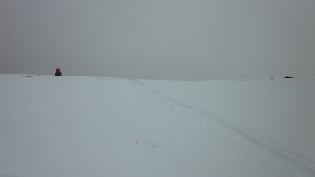
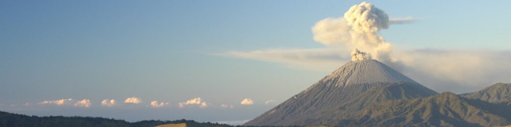
Approaching Mount Chaitén, the landscape unfolds with stark contrasts: dense, emerald temperate rainforest gives way to a haunting volcanic caldera scarred by recent eruptions. The trail ascends through a forest of standing dead trees, silent witnesses to the 2008 eruption’s fury. As you climb, the air thickens with the scent of damp earth and faint sulfur, hinting at the volcano’s restless nature. Reaching the caldera rim, the panorama reveals a steaming rhyolite lava dome nestled within the vast crater, a raw testament to geological power and renewal. The emotional impact of standing on this active caldera’s edge is profound—a moment where Earth’s dynamic forces are palpable and humbling.
Mount Chaitén: Geological Background
Mount Chaitén is a caldera volcano approximately 3 kilometers in diameter, formed by explosive eruptions that emptied its magma chamber and caused the summit to collapse. Its most recent eruptive phase began abruptly in May 2008 after centuries of dormancy, producing massive ash plumes, pyroclastic flows, and a rhyolitic lava dome within the caldera. The volcano’s obsidian lava is notable for its translucent grey color and was historically used by indigenous peoples for tool-making. The caldera floor hosts fumaroles and steam vents, releasing sulfurous gases that color the landscape and signal ongoing volcanic activity. This dynamic geology offers trekkers a rare glimpse into the processes shaping Earth’s surface.
Terrain and Hiking Experience on Mount Chaitén
The trek begins in lush temperate rainforest, with a trail that gradually climbs through a mix of living and dead trees, evidence of the 2008 eruption’s impact. The path steepens as it approaches the caldera rim, transitioning to volcanic ash slopes and rocky terrain. Hikers encounter loose pumice and volcanic debris, requiring careful footing. The ascent is steady but manageable, with occasional wind gusts near the summit adding to the challenge. Temperature shifts are noticeable, cooler and windier at higher elevations. The trail’s varied terrain demands moderate fitness and attention but rewards with dramatic views and intimate contact with volcanic landscapes.
What Makes the Mount Chaitén Trek Unique
Mount Chaitén’s trek is distinguished by its active caldera setting, where hikers observe a living volcanic dome within a vast crater formed by recent explosive eruptions. Unlike many volcano hikes, the trail does not summit the lava dome itself due to safety concerns, but the caldera rim offers unparalleled views of steaming fumaroles and fresh volcanic deposits. The juxtaposition of regenerating rainforest with barren volcanic terrain creates a striking visual and ecological contrast. The volcano’s recent activity and ongoing fumarolic emissions provide a rare opportunity to witness geological processes in action, making this trek a compelling adventure for volcano enthusiasts.
The Summit and Crater Experience at Mount Chaitén
Reaching the caldera rim, hikers are greeted by a breathtaking vista: the steaming rhyolite lava dome dominates the crater floor, emitting wisps of sulfurous steam that carry a sharp, mineral scent. The ground beneath is warm in places, a reminder of the volcano’s latent heat. The crater’s vastness and the surrounding rugged peaks evoke a sense of Earth’s immense power and fragility. Sounds of escaping gases punctuate the silence, while panoramic views stretch over the Gulf of Corcovado and the dense forests below. This sensory encounter with an active volcanic caldera is both humbling and exhilarating.
Best Time to Trek Mount Chaitén
The optimal trekking season runs from late spring to early autumn (November to March), when weather conditions are most stable and temperatures range between 5°C and 20°C. This period offers clearer skies and reduced rainfall, enhancing trail safety and visibility. Winter months bring heavy rain and colder temperatures, increasing trail slipperiness and risk. Volcanic activity is continuously monitored, and trekkers should check for any alerts or restrictions before planning their hike. Early morning climbs are recommended to avoid afternoon winds and to capture the best light for views and photography.
Trekking Routes and Trail Options on Mount Chaitén
The primary route starts from a designated car park approximately 24 kilometers north of the town of Chaitén, accessible by private vehicle or limited public transport. The trail is well-marked and ascends steadily through forest before reaching the caldera rim. The round trip covers about 3.1 kilometers with an elevation gain of roughly 600 meters, typically completed in 3 to 4 hours. Guided tours are available, offering expert insights into the volcano’s geology and history, though self-guided hikes are common due to the trail’s clear signage. No alternative summit routes exist due to safety restrictions around the active lava dome.
Difficulty Assessment of the Mount Chaitén Trek
Mount Chaitén’s trek is classified as a moderate volcano trek. The trail’s steep sections and loose volcanic ash require good balance and moderate fitness. Altitude is relatively low at 1,122 meters, minimizing altitude sickness risk. No technical climbing skills or equipment are necessary, but hikers should be prepared for uneven terrain and variable weather. The hike suits experienced walkers comfortable with moderate elevation gain and some exposure to wind near the caldera rim.
Essential Gear for Trekking Mount Chaitén
Recommended gear includes sturdy hiking boots with good grip for volcanic ash and rocky terrain, trekking poles to aid balance on loose slopes, and gaiters to protect against ash and debris. A windproof and waterproof jacket is essential due to variable weather and wind exposure near the summit. Sun protection—hat, sunglasses, and sunscreen—is important as the trail offers limited shade. Carry sufficient water and snacks for the 3 to 4-hour hike. A headlamp is useful for early starts. While gas masks are generally not required, hikers should stay informed about volcanic gas conditions and heed any advisories.
Safety and Volcanic Hazards on Mount Chaitén
Trekking Mount Chaitén involves inherent volcanic risks including exposure to volcanic gases like sulfur dioxide, unstable crater edges, and loose scree that can cause slips or falls. Sudden weather changes and strong winds near the caldera rim increase hazards. Eruption activity is monitored by Chile’s SERNAGEOMIN agency, and hikers must respect closures and warnings. Staying on marked trails, avoiding fumarole areas, and traveling with a guide if unfamiliar with volcanic terrain enhance safety. Emergency plans and communication devices are recommended due to the remote location.
Permits, Guides, and Logistics for Mount Chaitén Trek
No formal permits are required to hike Mount Chaitén, but park entrance fees may apply within Pumalin National Park. Guided tours are available and recommended for those seeking detailed geological interpretation and enhanced safety. The trailhead is accessible by private vehicle or limited daily bus service from Chaitén town. Visitors should verify current volcanic activity status and trail conditions with local authorities or visitor centers before embarking. Seasonal closures may occur due to volcanic unrest or weather.
Where to Stay Near Mount Chaitén
The town of Chaitén serves as the primary base for volcano treks, offering guesthouses, hostels, and small hotels with basic amenities. For a more immersive nature experience, camping is available within Pumalin National Park near the trailhead at El Volcán sector. Nearby lodges such as those in Caleta Gonzalo provide comfortable accommodation with access to additional hiking and nature activities. Early booking is advised during peak season due to limited options in this remote region.