
Trekking Mount Moroto: A Complete Guide to Uganda’s Remote Stratovolcano Adventure
Mount Moroto, a dormant stratovolcano in northeastern Uganda, offers a unique trekking experience with panoramic views, rich biodiversity, and cultural encounters with the Tepeth and Karamojong peoples. This guide covers geology, routes, safety, and practical tips for an unforgettable volcano hike.
Quick Volcano Snapshot
| Volcano type | Stratovolcano |
|---|---|
| Elevation | 3,083 meters (10,115 feet) |
| Location | Northeastern Uganda, Karamoja region |
| Activity status | Dormant |
| Trekking difficulty | Moderate |
| Typical trek duration | 2-3 days |
| Altitude gain | Approximately 1,700 meters |
| Terrain type | Rugged volcanic ridges, montane forest, rocky outcrops, savannah grasslands |
| Best season | December to February and June to September (dry seasons) |
| Temperature range | 10°C to 25°C |
| Permit requirement | Required; local guides recommended |
The Experience of Hiking Mount Moroto
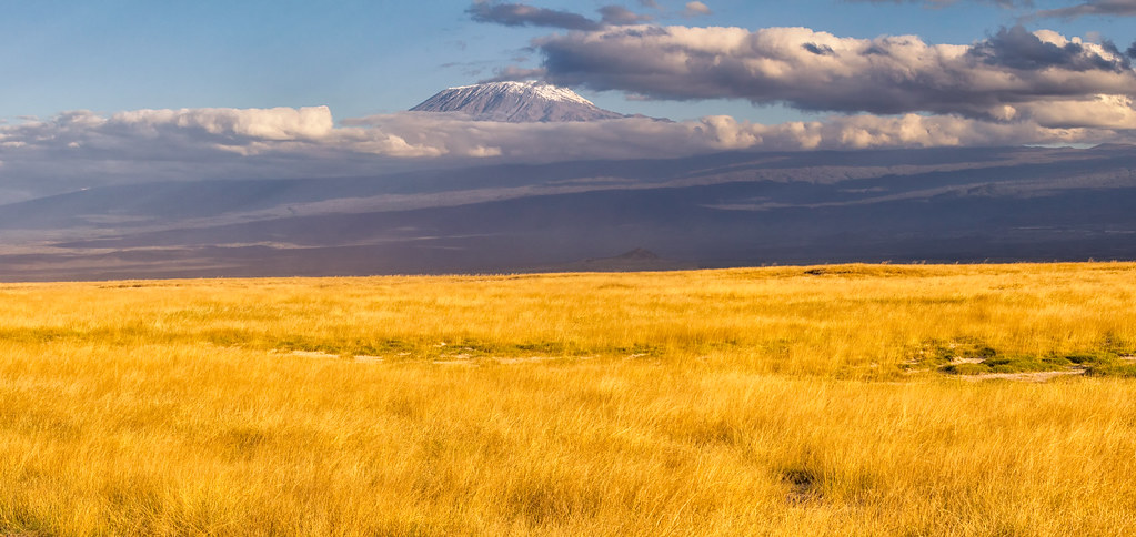
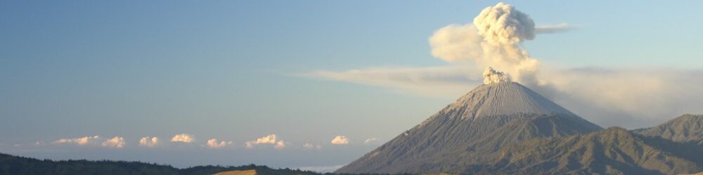
Approaching Mount Moroto, the landscape unfolds as a dramatic volcanic sentinel rising sharply from the Karamoja plains. The trek immerses hikers in a raw geological theatre where ancient lava flows meet rugged escarpments. The contrast between the barren volcanic ridges and pockets of lush montane forest evokes a profound sense of Earth’s power and timelessness. Reaching the summit rewards trekkers with sweeping panoramas of Uganda’s northeastern wilderness and distant Kenyan horizons, an emotional climax that connects adventurers to both nature and culture.
Geological Background of Mount Moroto
Mount Moroto is a classic stratovolcano formed over 500 million years ago as part of the Eastern Rift Mountains within the East African Rift system. Its structure is composed mainly of metamorphic and igneous rocks, including granite, gneiss, and basaltic volcanic plugs. The mountain’s rugged ridges and deep valleys result from prolonged tectonic uplift and erosion. Though dormant, Moroto’s volcanic heritage is visible in its steep escarpments, basalt outcrops, and seasonal streams fed by springs emerging from volcanic rock layers.
Terrain and Hiking Experience on Mount Moroto
The trek features a mix of steep ascents over volcanic scree, rocky ridges, and forested sections. Hikers navigate uneven trails that wind through montane forests of olive, fig, and podocarpus trees before emerging onto open grasslands and rocky outcrops. The terrain demands moderate fitness due to elevation gain and occasional rock scrambling, especially near the summit. Weather can shift rapidly, with cool mountain breezes contrasting the warmer plains below. The trail’s ruggedness enhances the sense of wilderness and adventure.
What Makes the Mount Moroto Trek Unique
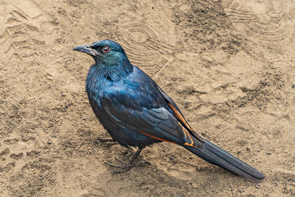
Mount Moroto stands out for its isolation and cultural richness. Unlike crowded volcano treks, it offers solitude and intimate encounters with the Tepeth and Karamojong peoples, whose traditions and histories are woven into the landscape. The mountain’s biodiversity includes over 220 bird species and rare mammals, making it a hotspot for wildlife and birdwatching. The panoramic views from the summit encompass the vast Karamoja plains and neighboring Kenya, creating a rare blend of geological grandeur and cultural immersion.
The Summit and Crater Experience
Reaching the summit of Mount Moroto, hikers stand at approximately 3,083 meters, greeted by expansive views stretching across northeastern Uganda and into Kenya. The summit ridge offers dramatic cliffs and vantage points overlooking deep valleys. Though the volcano is dormant with no active crater, the geological formations reveal ancient volcanic activity. The air is crisp, and the silence profound, punctuated only by the calls of endemic birds. The summit camp below Imagit peak provides a serene setting to reflect on the mountain’s natural and cultural significance.
Best Time to Trek Mount Moroto
The ideal trekking seasons are during Uganda’s dry periods from December to February and June to September. These months offer stable weather, clearer skies, and safer trail conditions. The wet seasons bring heavy rains that can make trails slippery and increase the risk of landslides. Early morning starts are recommended to avoid afternoon winds and heat. Trekking during dry seasons also enhances wildlife spotting and birdwatching opportunities.
Trekking Routes and Trail Options
The primary route begins at Singila near Moroto town (elevation 1,370m) and ascends steeply to the Leworon campsite at about 2,300m, a typical first-day stop. From Leworon, trekkers continue to Imagit peak, the highest point, via two main paths: a forest trail or a more exposed cliff-edge route. The full ascent to the summit camp can take up to 9 hours. The descent follows a rugged, less-used trail to Kodonyo village, offering a challenging but rewarding bushwalking experience. Both guided and self-guided options exist, though local guides are highly recommended.
Difficulty Assessment
Mount Moroto is classified as a moderate volcano trek. The terrain includes steep slopes, rocky sections requiring basic scrambling skills, and uneven volcanic scree. Altitude gain of approximately 1,700 meters demands good cardiovascular fitness but no technical climbing equipment. Hikers should be prepared for variable weather and some physical endurance. This trek suits experienced hikers comfortable with multi-day mountain hikes but is accessible to determined novices with proper preparation.
Essential Volcano Trekking Gear
Recommended gear includes sturdy hiking boots with good grip for rocky and loose terrain, trekking poles to aid balance on steep ascents and descents, and gaiters to protect against volcanic ash and debris. A windproof and waterproof jacket is essential due to unpredictable mountain weather. Carry a headlamp for early starts or late finishes. Sun protection such as hats, sunglasses, and high-SPF sunscreen is vital since the mountain offers little shade. A hydration system and water purification tablets are advised. Though volcanic gases are minimal, a lightweight respirator can be useful if hiking near fumaroles or sulfur deposits.
Safety and Volcanic Hazards
Mount Moroto is dormant with no recent volcanic activity, minimizing eruption risks. However, hikers should remain cautious of unstable rocky sections, loose scree, and steep cliff edges. Sudden weather changes can bring strong winds and reduced visibility. Wildlife encounters require respect and caution. It is advisable to trek with local guides familiar with the terrain and emergency protocols. Monitoring by Uganda Wildlife Authority and local rangers ensures trail safety and timely warnings if conditions change.
Permits, Guides, and Logistics
Trekking Mount Moroto requires permits issued by Uganda Wildlife Authority or local authorities. Hiring a local guide is strongly recommended for navigation, cultural interpretation, and safety. Guides can be arranged through tour operators in Moroto town. Park entry fees and camping permits apply. Seasonal closures are rare but check in advance. Logistics include arranging transport to Moroto from Mbale or Soroti, with matatus and minibuses commonly used. Planning for food, water, and camping equipment is essential for multi-day treks.
Where to Stay Near Mount Moroto
Accommodation options near Mount Moroto include basic guesthouses and lodges in Moroto town, which serve as the main base for trekkers. Camping is possible at designated sites such as Leworon and below Imagit peak for multi-day hikes. Eco-camps and community-run campsites offer authentic experiences close to nature. Facilities are rustic, so prepare accordingly. Staying in Moroto town provides access to local markets, guides, and transport connections.