Climbing Mount Agung: The Ultimate Guide to Bali’s Highest Active Volcano Trek
Mount Agung, Bali’s tallest and most sacred active stratovolcano, offers a demanding trek through volcanic landscapes steeped in cultural significance. This guide covers geology, routes, safety, permits, and the unforgettable summit experience, including the iconic sunrise over Bali’s volcanic horizon.
Quick Volcano Snapshot
| Volcano type | Stratovolcano |
|---|---|
| Elevation | 3,142 meters (10,308 feet) |
| Location | Karangasem Regency, Bali, Indonesia |
| Activity status | Active |
| Trekking difficulty | Demanding |
| Typical trek duration | 8 to 12 hours round trip |
| Altitude gain | Approximately 1,500 meters (4,900 feet) |
| Terrain type | Steep forest trails, rocky lava slopes, volcanic ash, and loose scree |
| Best season | Dry season (April to September) |
| Temperature range | 5°C to 20°C near summit; warmer at base |
| Permit requirement | Required; guided trekking mandatory |
The Experience of Hiking Mount Agung
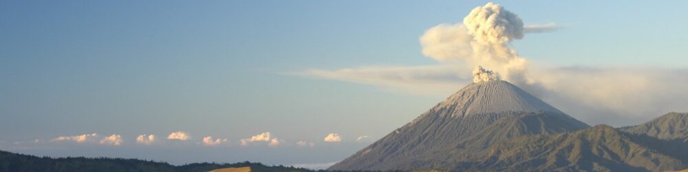
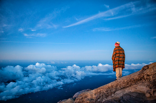
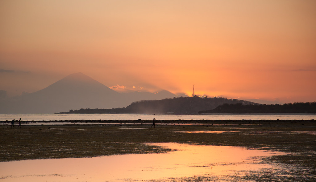
Approaching Mount Agung, the landscape shifts dramatically from lush Balinese forests to stark volcanic rock and ash. The towering peak dominates the horizon, its smoking crater a reminder of the earth’s raw power. As you ascend, the air thins and the terrain becomes rugged, challenging every step. Reaching the summit at dawn, you witness a breathtaking sunrise spilling golden light over Bali’s volcanic skyline, a moment charged with both natural majesty and spiritual reverence.
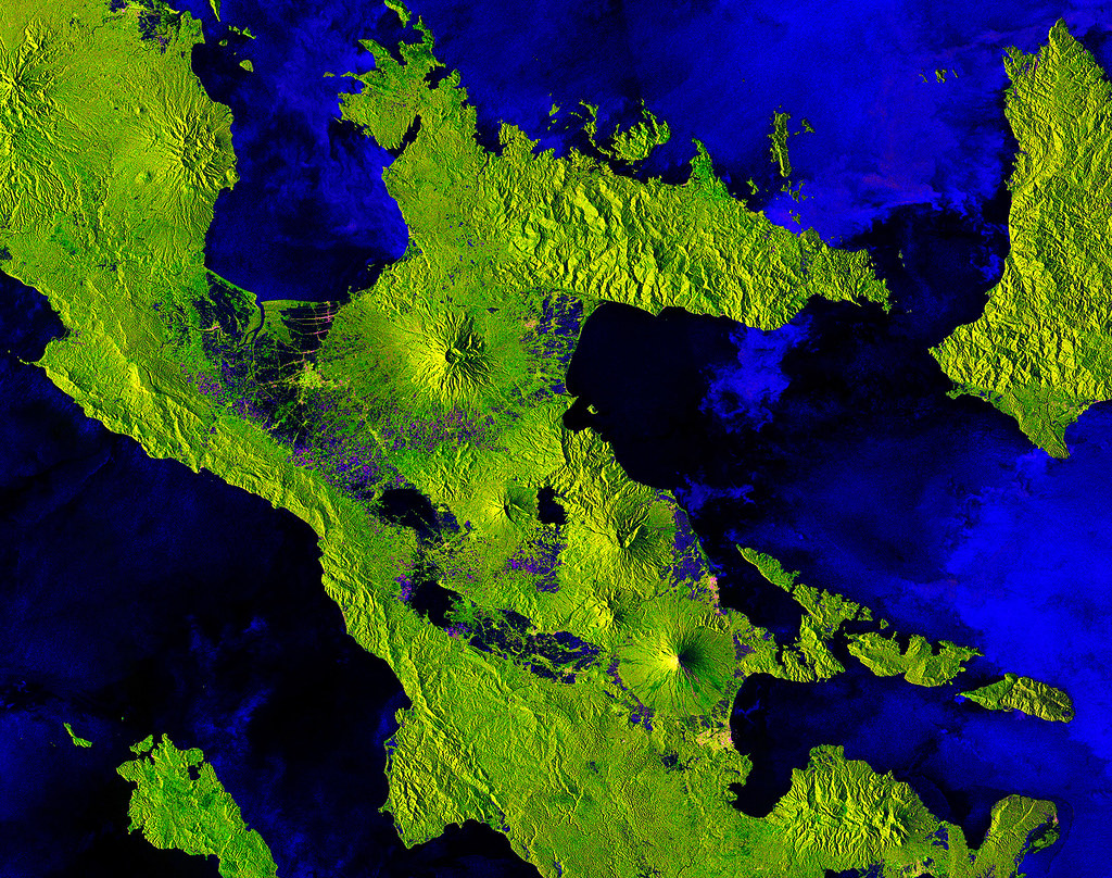
Mount Agung: Geological Background
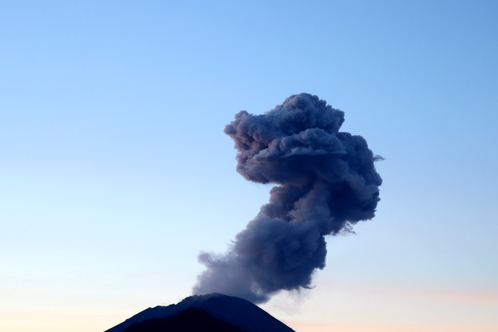
Mount Agung is a classic stratovolcano formed by layers of hardened lava, ash, and volcanic debris. Its formation dates back thousands of years, shaped by repeated eruptions that have sculpted its steep slopes and deep crater. Notable eruptions include the catastrophic 1963-64 event, which reshaped the landscape and impacted local communities. The crater features fumaroles emitting steam and sulfur gases, with deposits of volcanic minerals visible along the trail. Solidified andesite lava flows create rugged terrain, while thermal anomalies hint at the volcano’s persistent activity beneath the surface.
Terrain and Hiking Experience on Mount Agung
The trek begins in dense tropical forest, gradually giving way to barren volcanic rock and steep ash slopes. Hikers encounter loose pumice, sharp lava fragments, and sections requiring scrambling over jagged rocks. The trail’s incline averages around 45 degrees, demanding strong endurance and sure footing. Wind intensifies near the summit, and temperature drops significantly. Altitude effects become noticeable above 2,000 meters, making acclimatization and pacing essential. The descent can be treacherous, especially on loose scree, requiring careful navigation.
What Makes the Mount Agung Trek Unique
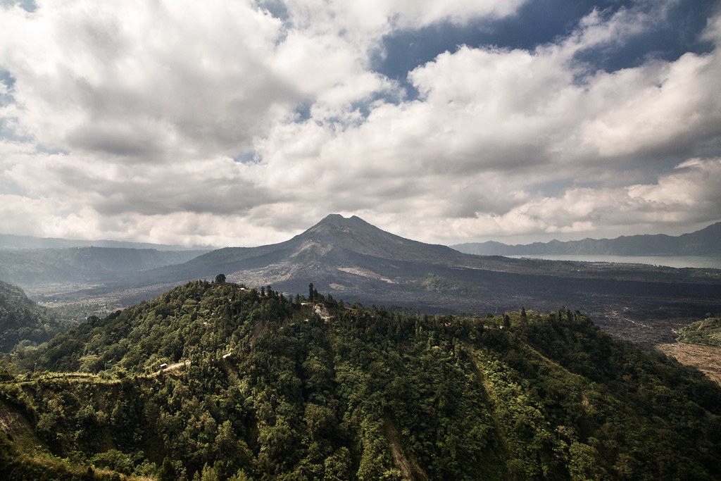
Mount Agung stands out for its combination of physical challenge, active volcanic features, and profound cultural significance. It is Bali’s highest peak and a sacred site, with ancient temples like Pura Besakih nestled on its slopes. The trek offers a rare chance to witness an active crater’s steaming vents and sulfurous smells while engaging with Balinese spiritual traditions. The summit sunrise reveals panoramic views of Bali, neighboring Lombok’s Mount Rinjani, and the vast ocean beyond, creating an unforgettable volcanic adventure.
Summit and Crater Experience
Reaching Mount Agung’s summit, hikers stand at 3,142 meters, greeted by a vast crater rim emitting steam and sulfurous gases. The air carries a distinct smell of sulfur, and the ground radiates residual heat from fumaroles. The panoramic vista encompasses Bali’s volcanic peaks, lush valleys, and the distant sea. The sunrise bathes the landscape in warm light, intensifying the spiritual atmosphere. The summit’s exposed ridge offers a thrilling vantage point, where the power of the earth is palpable and the silence profound.
Best Time to Trek Mount Agung
The optimal trekking season is the dry period from April to September, when trails are more stable and weather conditions favorable. Nighttime starts around midnight are necessary to reach the summit for sunrise. Avoid the rainy season due to slippery terrain and increased risk of storms. Volcanic activity can prompt temporary closures; always check current alerts from Indonesian authorities. Extreme weather, such as heavy rain or storms, can lead to official bans on climbing for safety reasons.
Trekking Routes and Trail Options
Two main routes lead to Mount Agung’s summit. The Pura Pasar Agung route starts at 1,600 meters and is shorter but steeper, typically taking 3 to 4 hours to the crater rim. It does not reach the absolute summit but offers spectacular views. The Besakih route begins at 950 meters near Bali’s Mother Temple and is longer and more demanding, requiring 5 to 7 hours to the summit with steep, technical sections. Both routes require guided trekking, with local guides providing cultural insights and safety support.
Difficulty Assessment
Mount Agung is classified as a demanding volcano ascent. The steep slopes, loose volcanic scree, and high altitude require good physical fitness and hiking experience. No technical climbing gear is needed, but scrambling and careful footing are essential. Altitude sickness is a risk above 2,500 meters. This trek is not suitable for beginners or casual hikers. Preparation, acclimatization, and a steady pace are critical for a safe and successful climb.
Essential Volcano Trekking Gear
Key gear includes sturdy hiking boots with excellent grip, trekking poles for stability on loose terrain, and gaiters to protect against volcanic ash. A warm, windproof jacket is vital for summit conditions, along with layered clothing for temperature changes. Headlamps are necessary for pre-dawn starts. Carry sufficient water and high-energy snacks, as there are no facilities on the trail. A raincoat is recommended during shoulder seasons. A gas mask or respirator is generally not required but may be useful if fumarole gases intensify.
Safety and Volcanic Hazards
Mount Agung’s active status means risks include sudden eruptions, toxic gases, unstable crater edges, falling rocks, and loose scree. Climbers must heed official warnings and avoid restricted zones. Weather can change rapidly, increasing hazards. The Indonesian government monitors volcanic activity closely, issuing alerts and closures as needed. Always climb with a licensed local guide who understands the terrain and emergency protocols. Carry a first aid kit and inform others of your itinerary.
Permits, Guides, and Logistics
Climbing Mount Agung requires permits issued by local authorities, and guided trekking is mandatory for safety and cultural respect. Guides can be hired in villages near trailheads such as Selat and Besakih. Permit fees and guide costs vary; confirm current prices before your trek. Access may be restricted during heightened volcanic activity or extreme weather. Booking through reputable tour operators ensures compliance with regulations and enhances safety.
Where to Stay Near Mount Agung
Accommodations range from guesthouses and eco-lodges in villages like Selat and Besakih to mid-range resorts such as Artha Agung Resort. Staying near trailheads allows early starts essential for sunrise summits. Options include homestays offering cultural immersion and trekking hostels catering to hikers. Booking in advance is recommended during peak trekking seasons.