Trekking Mount Gamalama: A Complete Guide to Indonesia’s Active Island Stratovolcano
Mount Gamalama, an active stratovolcano dominating Ternate Island in Indonesia, offers a compelling volcano trekking experience. This guide covers its geology, trekking routes, safety, and cultural context, providing expert insights for adventurous hikers seeking to explore one of Indonesia’s most active volcanic landscapes.
Quick Volcano Snapshot
| Volcano type | Stratovolcano |
|---|---|
| Elevation | 1715 meters |
| Location | Ternate Island, North Maluku, Indonesia |
| Activity status | Active |
| Trekking difficulty | Moderate |
| Typical trek duration | 7-8 hours round trip |
| Altitude gain | Approx. 1370 meters |
| Terrain type | Volcanic ash slopes, lava rock, cane grass, plantations |
| Best season | Dry season (May to September) |
| Temperature range | 15°C to 30°C |
| Permit requirement | No formal permit required; local sign-in and respect for traditional rules |
The Experience of Hiking Mount Gamalama
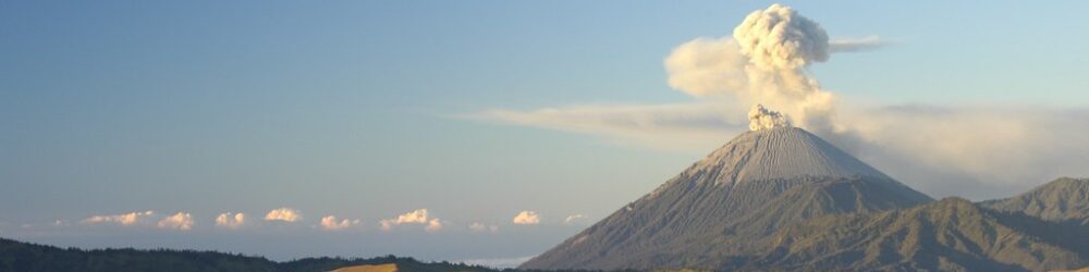
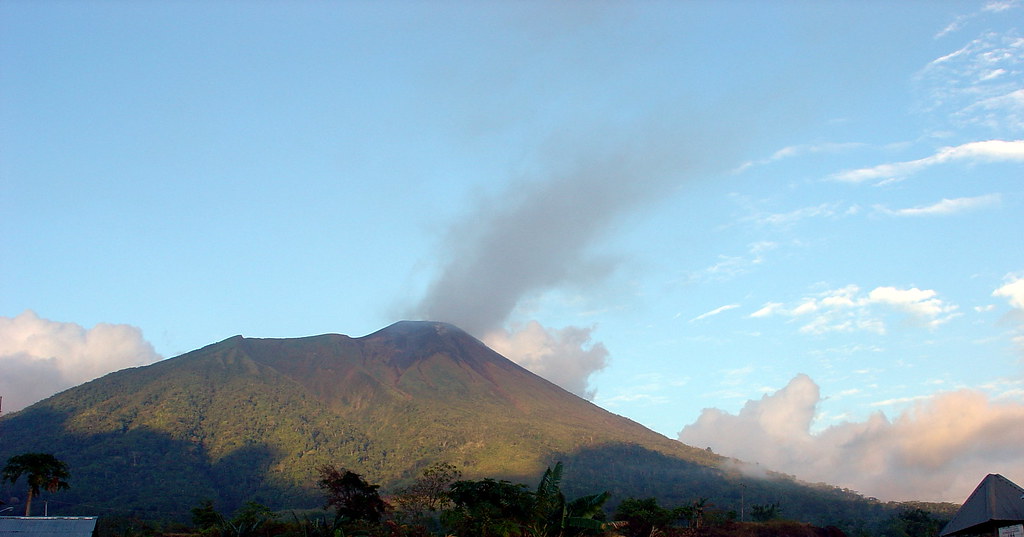
Approaching Mount Gamalama, the entire island of Ternate reveals itself as a towering volcanic cone rising sharply from the sea. The stark contrast between lush tropical plantations at the base and the barren, ash-covered summit creates a dramatic landscape. As you ascend, the air grows thinner and cooler, while the scent of sulfur intensifies. Reaching the crater rim, hikers confront the raw power of an active volcano — steaming fumaroles, sharp volcanic rocks, and panoramic views over the Maluku Islands evoke a profound sense of Earth’s restless energy.
Geological Background of Mount Gamalama
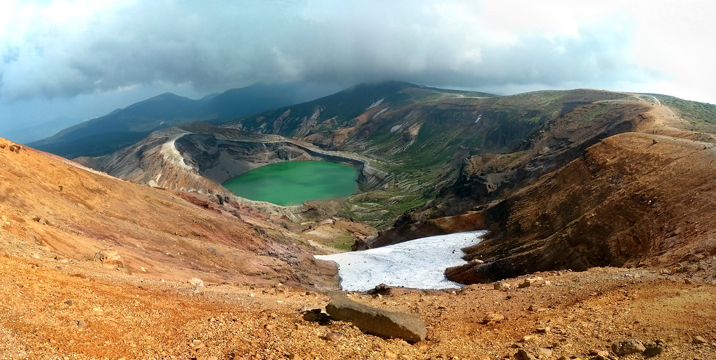
Mount Gamalama is a near-perfect conical stratovolcano that forms the entirety of Ternate Island. It is part of the Halmahera volcanic arc and has been highly active for centuries, with at least 77 documented eruptions since the 16th century. The volcano’s structure includes multiple summit craters and a rift zone with maars and vents. Its eruptions range from effusive basaltic lava flows to violent andesitic explosions producing pyroclastic flows. The 1775 eruption was particularly deadly, reshaping the landscape and creating crater lakes such as Danau Tolire Besar. The volcano’s surface features fumaroles, sulfur deposits, and steaming vents that reveal ongoing subterranean activity.
Terrain and Hiking Experience on Gamalama
The trek begins through fragrant plantations of clove, nutmeg, cinnamon, and durian, gradually giving way to dense cane grass and volcanic ash slopes. Trails vary from steep, loose pumice and ash to rocky scrambling near the summit. The ascent crosses several steep ravines and exposed ridges, demanding sure-footedness. Wind conditions intensify near the crater, and temperature can drop sharply. The terrain’s volcanic nature means hikers must navigate sharp volcanic rocks and unstable scree, especially on the final approach to the crater rim.
What Makes Mount Gamalama Trek Unique
Gamalama’s uniqueness lies in its island-wide presence, forming the entire landmass of Ternate. The volcano’s rich history intertwines with the spice trade era, surrounded by Portuguese and Dutch forts. The trek offers a rare combination of cultural heritage and active volcanic phenomena. The sacred status of the upper slopes, traditional rituals, and the ever-present sulfur fumes create an atmosphere unlike any other. The 2015 eruption altered the summit’s shape, adding a new vent and reshaping the climbing route, making each ascent a journey through a living, changing landscape.
Summit and Crater Experience
Reaching the summit rim is a sensory climax. The sulfurous smell is pungent and unmistakable, while steam vents hiss and crackle beneath your feet. The ground may feel warm in places, a reminder of the volcano’s active heart. From the crater edge, panoramic views stretch across the Maluku Islands, including neighboring volcanic peaks and the surrounding sea. The crater itself is a rugged amphitheater of jagged rocks and fumaroles, alive with geological energy. The experience is both humbling and exhilarating, a direct encounter with Earth’s fiery core.
Best Time to Trek Mount Gamalama
The optimal trekking season is during the dry months from May to September, when trails are less slippery and visibility is clearer. The wet season brings heavy rains, increasing the risk of landslides and slippery volcanic ash. Volcanic activity can cause sudden closures; it is essential to monitor local volcanic alerts and heed warnings. Early morning starts are recommended to avoid afternoon clouds and to experience the sunrise over the volcanic landscape.
Trekking Routes and Trail Options
Two main routes lead to the summit: the Marikurubu route and the Moya route. The Marikurubu trail starts at about 275 meters elevation and is steeper and less defined, requiring careful navigation especially on descent. The Moya route, beginning at 341 meters, is longer but features a clearer path used by locals accessing plantations. Both routes converge at the Terminal camp at approximately 1343 meters. From there, the final ascent crosses steep ravines and cane grass to the sacred zone near 1580 meters, then up to the crater rim. Guided treks are recommended for safety and local knowledge.
Difficulty Assessment
Mount Gamalama is classified as a moderate volcano trek. The ascent involves steep slopes, loose volcanic ash, and rocky sections requiring good balance and fitness. Altitude is moderate but can affect less acclimatized hikers. No technical climbing gear is needed, but hikers should be prepared for challenging terrain and variable weather. Fitness for a full-day hike of 7-8 hours is essential.
Essential Volcano Trekking Gear
Recommended gear includes sturdy hiking boots with excellent grip for volcanic rock and ash, trekking poles for stability, and gaiters to protect against fine ash. A windproof jacket is essential for summit winds and cooler temperatures. Carry a headlamp for early starts, sufficient water and hydration systems, sun protection including hat and sunscreen, and a respirator or mask to filter sulfur gases if needed. Lightweight layers and gloves are advisable for temperature shifts.
Safety and Volcanic Hazards
Trekking Gamalama involves risks from volcanic gases, unstable crater edges, loose rocks, and sudden weather changes. Sulfur fumes can be hazardous; sensitive individuals should carry masks. The crater rim is unstable and requires caution. Pyroclastic flows and ash fall are possible during eruptions, so monitoring by Indonesian volcanic agencies (PVMBG) is critical. Respect local warnings and avoid trekking during elevated activity or official closures. Guides provide essential safety knowledge.
Permits, Guides, and Logistics
No formal permits are required to climb Mount Gamalama, but hikers must register at the village trailheads. Local guides are strongly recommended for navigation, safety, and cultural respect. Guides can be arranged in Moya or Marikurubu villages or through hotels in Ternate City. The volcano is sometimes closed due to activity; always check current conditions with local authorities before trekking.
Where to Stay Near Mount Gamalama
Ternate City offers a range of accommodations from budget guesthouses to mid-range hotels, all within 15-20 minutes of trailheads. For a more immersive experience, eco-lodges and local homestays in Moya or Marikurubu villages provide proximity to the mountain and cultural interaction. Camping is possible at the Terminal camp on the mountain, but requires preparation and permission from local guides.