
Climbing Mount St. Helens: The Definitive Volcano Trekking Guide to Washington’s Iconic Eruption Landscape
Mount St. Helens offers a compelling volcano trekking experience combining raw geological power, challenging terrain, and a vivid story of nature’s resilience. This guide covers the volcano’s geology, detailed route options, permit requirements, seasonal considerations, and practical advice for adventurers seeking to summit this active stratovolcano in Washington State.
Quick Volcano Snapshot
| Volcano type | Stratovolcano |
|---|---|
| Elevation | 8,365 ft (2,550 m) at crater rim |
| Location | Washington State, United States |
| Activity status | Active |
| Trekking difficulty | Moderate |
| Typical trek duration | 7 to 12 hours (day hike); 2-4 days (backpacking loops) |
| Altitude gain | Approximately 4,500 ft (1,372 m) on Monitor Ridge route |
| Terrain type | Volcanic ash slopes, pumice fields, boulder fields, crater rim |
| Best season | July to October |
| Temperature range | 40°F to 80°F (4°C to 27°C) in summer months |
| Permit requirement | Required April 1 to October 31; self-issued off-season |
The Experience of Hiking Mount St. Helens
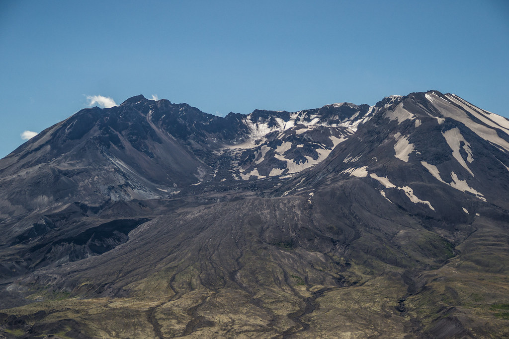
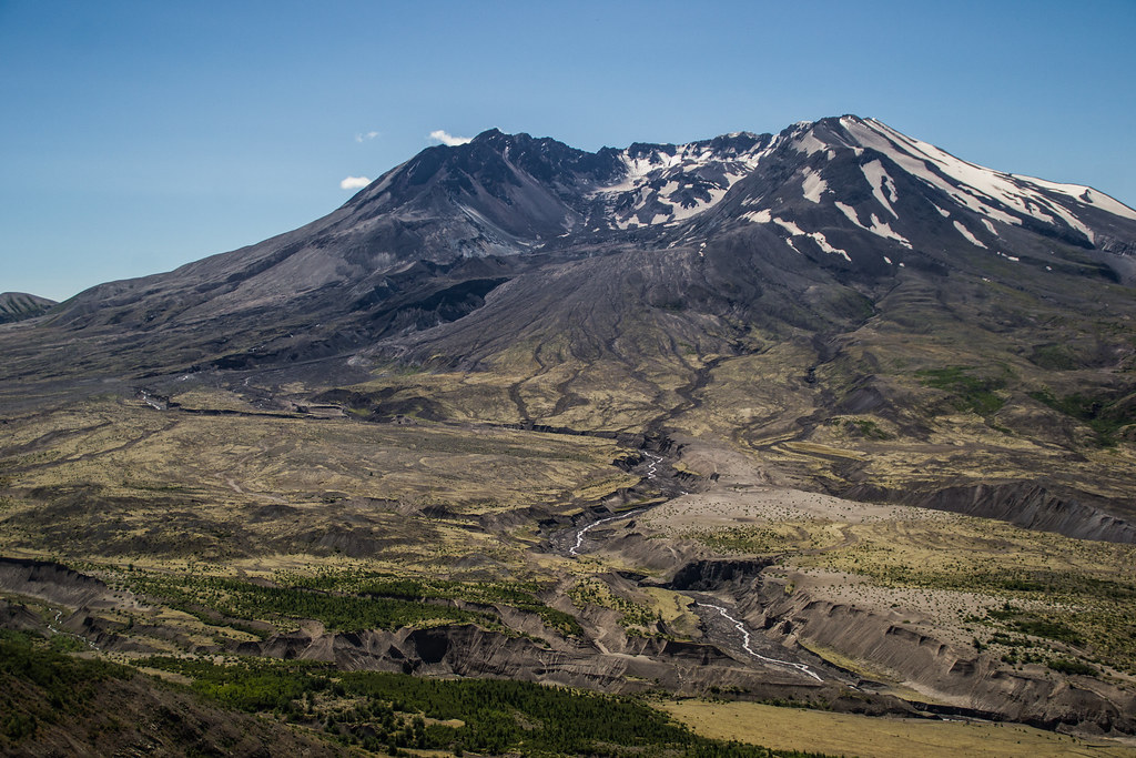
Approaching Mount St. Helens, the landscape unfolds like a raw canvas of geological upheaval. The stark contrast between the barren pumice fields and the recovering forests evokes a profound sense of Earth’s power and renewal. As you ascend, the air thins and the terrain shifts from dense woods to open ash slopes, exposing the vast horseshoe-shaped crater formed by the 1980 eruption. Reaching the summit, the panorama reveals a surreal vista of the growing lava dome, surrounding Cascade peaks, and the scars of one of the most dramatic volcanic events in North America.
Mount St. Helens: Geological Background
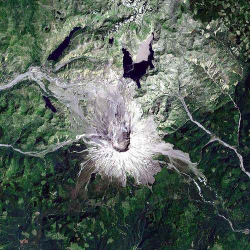
Mount St. Helens is a stratovolcano formed by layers of hardened lava, tephra, and volcanic ash. Its infamous 1980 eruption was a catastrophic lateral blast that removed the northern flank, creating a massive crater open to the north. The eruption produced pyroclastic flows, lahars, and ashfall that reshaped the landscape. Today, the volcano features a rapidly growing lava dome within the crater, fumaroles emitting steam and sulfur gases, and mineral deposits from volcanic activity. The area remains geologically active, with ongoing monitoring for seismic and gas activity.
Terrain and Hiking Experience on Mount St. Helens
The hike begins through forested trails that quickly give way to open meadows and pumice fields. Ascending Monitor Ridge involves scrambling over loose volcanic rocks and ash-covered boulders. The terrain is steep and rugged, with sections of unstable scree and sharp pumice that can shred skin without proper gear. Wind exposure increases near the summit, and temperature fluctuations are common. The final ascent to the crater rim is a slow, steady climb through ash and small rocks, demanding endurance and careful footing.
What Makes the Mount St. Helens Trek Unique
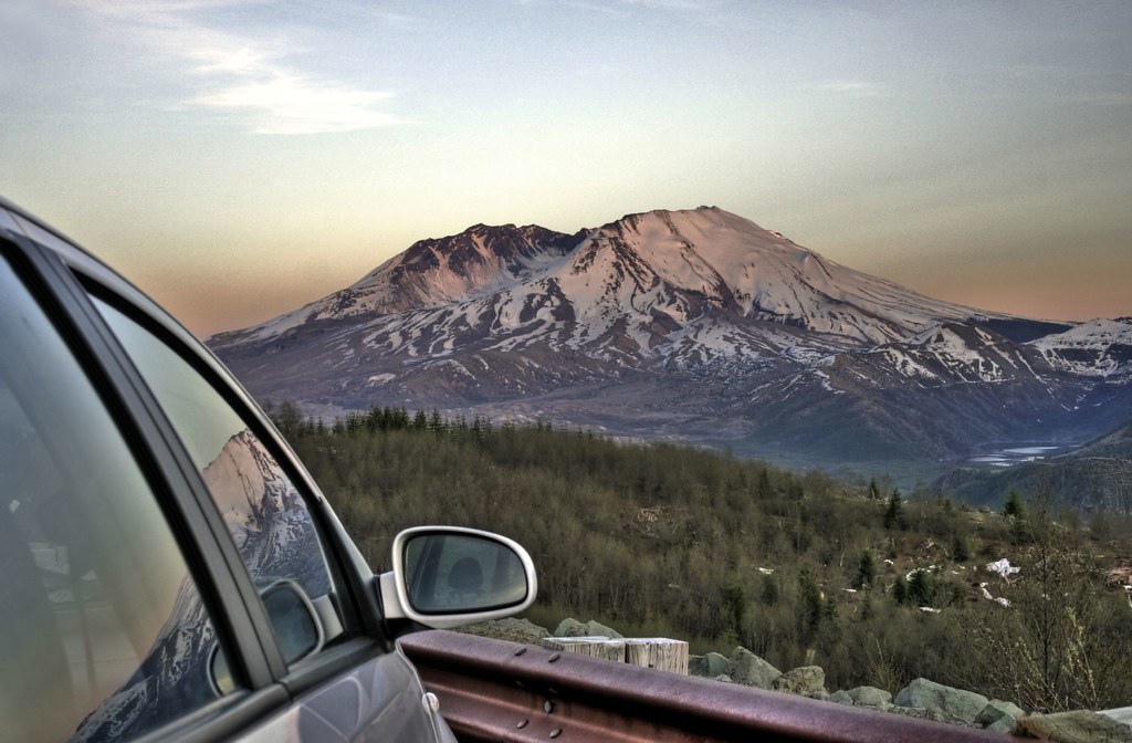
Mount St. Helens stands out for its living geological history and ecological recovery. The 1980 eruption’s blast zone offers a rare glimpse into volcanic devastation and nature’s resilience. Hikers witness a landscape where new forests grow amid volcanic deserts, and a lava dome visibly expands within the crater. The trek combines scientific intrigue with dramatic scenery, including views of multiple Cascade volcanoes and the chance to explore backcountry loops like the Loowit Trail that circle the mountain.
Summit and Crater Experience
Reaching the summit places you on the edge of a vast horseshoe-shaped crater, where the earth still breathes through fumaroles and steam vents. The sulfurous scent mingles with the crisp mountain air, while the heat from volcanic gases can be felt near vents. The view encompasses the growing lava dome, the newest glacier forming a horseshoe around it, and distant peaks like Mount Rainier and Mount Adams. The crater rim’s fragile cornices demand caution but reward climbers with an unforgettable sensory encounter with active volcanism.
Best Time to Trek Mount St. Helens
The prime trekking season runs from July through October when trails are mostly snow-free and weather is stable. Snowpack can linger into July some years, requiring caution and possible use of microspikes or ice axes. Summer months offer warmer temperatures and longer daylight but can bring crowds on weekends. Early season and late autumn hikes risk snow and unpredictable weather. Always check current volcanic activity and trail conditions before planning your climb.
Routes and Trail Options
The most popular route is the Monitor Ridge Trail, starting at Climber’s Bivouac, covering about 10 miles round trip with 4,500 feet elevation gain. This strenuous day hike requires a climbing permit during quota season. For multi-day backpackers, the Loowit Trail circumnavigates the mountain over 30-36 miles, offering solitude and diverse terrain but demanding expert navigation skills. Other routes include the Worm Flows Trail and Mount Margaret Backcountry, each with unique geological features and permit requirements.

Difficulty Assessment
Mount St. Helens is classified as a moderate volcano trek. The terrain is steep and rugged but non-technical, suitable for hikers in good physical condition. The main challenges are the loose volcanic ash, pumice, and boulder fields, combined with significant altitude gain. No technical climbing gear is required for the Monitor Ridge route, but experience with scrambling and endurance is essential. The Loowit Trail is strenuous and recommended only for expert hikers.
Essential Volcano Trekking Gear
Key gear includes sturdy hiking boots with excellent grip, trekking poles for stability on loose terrain, and gaiters to protect against abrasive volcanic ash. Layered clothing and a windproof jacket are vital due to variable weather and wind exposure. A headlamp is recommended for early starts. Carry ample water and sun protection, as shade is minimal. During shoulder seasons, microspikes and an ice axe may be necessary for snowfields. A climbing permit and identification must be carried on the route.
Safety and Volcanic Hazards
Volcanic gases such as sulfur dioxide can be present near fumaroles; hikers with respiratory issues should exercise caution. The crater rim features unstable edges and cornices that can collapse. Loose scree and pumice increase the risk of falls. Sudden weather changes and strong winds are common near the summit. Eruption risk is monitored continuously by the USGS, and climbers must heed closures and warnings. Always stay on designated trails and avoid restricted zones.
Permits, Guides, and Logistics
Climbing permits are mandatory from April 1 to October 31 to limit daily climbers and protect the environment. Permits cost $15 per person plus a reservation fee and are released monthly on recreation.gov. Groups up to 12 people share one permit. Outside quota season, permits are free and self-issued at trailheads. Guided climbs are available and recommended for first-timers. Parking passes and adherence to safety regulations are required. Early permit booking is essential during peak season.
Where to Stay Near Mount St. Helens
Accommodations range from campgrounds and eco-camps near trailheads to lodges and guesthouses in nearby towns like Castle Rock and Cougar. The Mount St. Helens Visitor Center offers educational resources and is a good base for planning. For multi-day backpackers, permit-controlled campsites along the Loowit Trail provide rustic but maintained options. Proximity to Portland and Seattle makes day trips feasible, but overnight stays enhance the experience.